
Preparing For Our Vancouver Island Circumnavigation (VIC 2020)
As we sit through the winter months dreaming of fleeing our busy everyday lives, we can’t help but think about sailing away from reality into the warmth of a British Columbia summer.
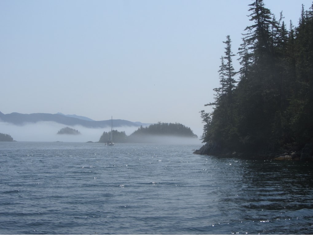
We imagine meeting a pod of porpoises or orcas. We can see waterfalls lining the coast, snow- capped mountains, and smooth seas rich with fish. Sailing is our way to recharge while enjoying some of the world’s best cruising grounds.
Now flash back to reality, and we’ve realized that our Vancouver Island (VI) circumnavigation is only three and a half months away! It’s time we buckle down and start planning.
Why Do We Cruise Our West Coast?
Asking sailors why they cruise is like asking an artist why they paint. We sail to hone our skills, to depend upon our own resources, to find our independence, and to enjoy some of mother nature’s best work.
While cruising, we are challenged every moment as each day’s sail is different and when we return to our home port, we are keen to get back out again.
Circumnavigating VI
Due to early summer prevailing NW winds, we normally circumnavigate VI in a counterclockwise direction.
Starting from our home base in Sidney, B.C. we follow the east coast of VI to Port McNeill, around Cape Scott and then down the west coast past Tofino.
On the inside of VI, we cruise in relatively protected waters, on the West Coast of VI, we sail in more challenging open water. Direct line nautical mileage is normally about 600NM, but on circumnavigations we may log as many as 1,000 NM.
Crew Preparation
Prior to sailing, we plan how much time we’ll have at sea with each student. Since we connect with students along our route, we want to make sure we make the best use of their time.
As each leg has different course options, we work together to decide the best course for each of them. For what to bring, please check: https://tulasailing.com/cruising-courses/
Prior to sailing, It is essential for students to come aboard with their Pleasure Craft Operator Card (PCOC). Students can obtain their PCOC online and if assistance is needed, they can contact Peter. If students would like to fish, salt-water fishing licenses can be obtained at: https://www.pac.dfo-mpo.gc.ca/fm-gp/rec/licence-permis/application-eng.html
When circumnavigating VI, we often cruise in remote areas where cell-phone coverage is virtually non-existent. Tula’s VHF marine radio is the only connection to the planet for several days and we teach our marine radio course enroute.
Learn more about Tula's sailing courses
Vessel and Other Preparation
With the crew all prepped and ready, it’s time to prepare SV Tula. We start by checking our supply of tools, spare parts, filters, belts, fluids, and impellers, and we also ensure our starter, alternator, and various pumps are in top shape.
We carry extra diesel fuel as fuel stops are few on the West Coast of VI. With good winds, we normally sail so our fuel consumption is minimal.
During our circumnavigation, we hope to be catching salmon to enjoy for meals. To do this, we have to make sure all of our fishing gear is aboard SV Tula. Organizing and preparing this gear can by tricky with the variety of items needed, but all the work will be worth it when we catch our first fish.
Navigation
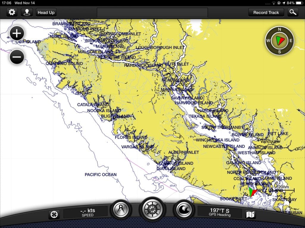
Like many modern sailors, we bring along our iPad Pro to navigate our way through the circumnavigation. At home, on the iPad, we plot each separate route for the 600nm around the island.
Before we leave the marina, we transfer these routes by on-board WI-FI to the Garmin chart-plotter at the helm.
Each morning at breakfast, we review the route for the day and ensure we have back-up anchorages to head into in the event of adverse weather.
Circumnavigating VI requires the use of 27 paper charts and we always have the current marine chart at the helm for the area we are sailing in.
Weather, Wind and Tide Apps
Each morning prior to sailing we sit down over coffee and check the detailed marine weather forecasts, the wind and tide conditions, traffic, and best fish locations.
Since Mother Nature can throw anything our way, we stay informed through VHF Marine Radio and monitor Environment Canada’s regular marine weather forecasts.
We keep a close eye on the 3 barometers we have aboard SV Tula. Wind conditions are pivotal for a steady sail. Since we will be sailing during early summer, traffic tends to be much lighter, but we still check Marine Traffic and Ship-Finder.
Fish at times can be difficult to locate, but using various fishing apps such as www.tides4fishing.com, and our on-board fish-finder sonar, we can follow schools of fish ensuring we can have a delicious fish dinner or fresh sushi as a snack.
We are well aware of the fragile state of our fish stocks and we normally take one fish for meals and follow catch and release policies.
Time to Sail
Prepping for the circumnavigation can be time-consuming, but it is important to be fully self-sufficient while at sea. Having a thorough preparation list ensures a smooth sail where our students can learn in a safe and fun environment.
If you would like a copy of our VI 2020 Detailed Voyage Plan, please contact Peter.
TulaSAILING Inc. is a Vancouver Island, B.C. based company specializing in training for those interested in extended coastal cruising. We teach Sail Canada Courses and CPS Marine Radio Courses to students from around the globe.
Would you like to join SV Tula’s Vancouver Island circumnavigation this summer? Contact Peter and come along.